Nandurbar District, Maharashtra: Toranmal, Tribal Culture, Temples & Travel Guide
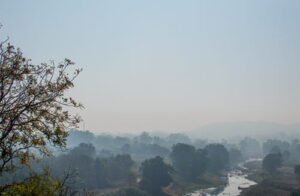
Nandurbar sits in the far northwest corner of Maharashtra, where the state meets both Gujarat and Madhya Pradesh simultaneously. The Satpura range rises to the north, the Tapi River defines the southern boundary, and the Narmada forms the northern edge against Madhya Pradesh. In between lies one of Maharashtra’s most tribal-dense, least-visited, and geographically dramatic districts.
Nandurbar, historically known as “Nandanagri” after King Nandaraja and “Rasika” in ancient times, boasts a rich and layered history. The region, once called Seunadesa after King Seunchandra of the Yadava dynasty, eventually became part of Khandesh, a name linked to the Faruqi kings. Over the centuries, Nandurbar witnessed the reign of many prominent dynasties, including the Mauryas, Satavahanas, Rashtrakutas, and Chalukyas.
The district’s two most celebrated tourist attractions sit at geographical extremes. Toranmal is a charming hill station nestled in the Satpura Range, sitting at an altitude of approximately 1,150 metres. The Gorakhnath Temple here is the site of Maharashtra’s most dramatic Mahashivratri pilgrimage — thousands walk barefoot for days from Gujarat, Madhya Pradesh, and across the district to reach it. At the other end of the district, the Unapdev hot springs near Shahada carry connections to the Ramayana.
But Nandurbar is perhaps most distinctively the district of the Bhil and Pawara tribal communities, whose culture, festivals, and Warli-tradition art make it one of Maharashtra’s most culturally unique territories. The Bhagoria Festival — a Bhil community marriage-selection festival — draws visitors from across the region every March.
Nandurbar District, Maharashtra — Quick Overview
| Feature | Details |
| State | Maharashtra |
| District Headquarters | Nandurbar town |
| District Formed | 1 July 1998 (carved from Dhule district) |
| Area | ~5,034 sq km |
| Location | Extreme northwestern Maharashtra |
| Borders | Gujarat (W & N), Madhya Pradesh (N & E), Dhule (S & SE) |
| Rivers | Narmada (N boundary with MP), Tapi (S); Gomai, Panzara |
| Famous For | Toranmal Hill Station, Gorakhnath Temple, Unapdev Hot Springs, Asthamba tribal fair, tribal (Bhil & Pawara) culture |
| Dominant Communities | Bhil, Pawara, Koli (major tribal communities) |
| Nearest Airport | Surat Airport, Gujarat (~200 km); Aurangabad Airport (~280 km from Toranmal) |
| Railway Station | Nandurbar Railway Station; Dondaicha (~76 km from Toranmal) |
| Best Time to Visit | October to May (Toranmal); March (Bhagoria Festival) |
| Summer Temperature | 28°C – 44°C (plains); cooler at Toranmal |
| Winter Temperature | 10°C – 26°C |
| Languages Spoken | Marathi, Bhili, Pawari, Gujarati, Hindi |
| Key Talukas | Nandurbar, Shahada, Taloda, Akkalkuwa, Akrani (Dhadgaon), Navapur |
History of Nandurbar District
1. Ancient and Medieval Layers — Savalda Culture to Khandesh Sultanate
Archaeological traces of the Savalda culture — a Bronze Age culture identified in the Khandesh region — have been found in the Nandurbar area, indicating human occupation stretching back to prehistoric times. The name of the district, as with many places in this part of the Deccan, has undergone several changes in accordance with the prevailing political powers of different periods.
Over the centuries, Nandurbar witnessed the reign of many prominent dynasties, including the Mauryas, Satavahanas, Rashtrakutas, and Chalukyas. The region became part of Khandesh — a historical division of the Deccan — under the Faruqi kings (the Khandesh Sultanate) in the 14th–16th centuries. The Faruqis made Thalner (in present-day Dhule) their capital and the Nandurbar area was part of their domain.
2. Akrani Fort and the Rajput Connection
In the remote highlands of present-day Akrani taluka, within the Satpura mountain range, there is a fort said to have been established by Rajput settlers. It is stated that, following the Battle of Haldighati in 1576, a conflict between Maharana Pratap and the forces of the Mughal emperor Akbar, Akkarani, accompanied by several Rajput retainers, migrated south and took refuge in the Akrani hills. The fort is believed to have been constructed during this period. The local name “Akrani Mahal” preserves this Rajput connection, and the taluka is named Akrani (also called Dhadgaon) to this day.
3. Mughal, Maratha, and British Periods
Nandurbar was later annexed by the Mughals under Akbar, who renamed Khandesh to Dandes in honor of his son, Daniyal. After the Mughal decline, the Marathas gained control, and in 1818, the British took over. Nandurbar also contributed to India’s independence struggle, particularly during the Quit India Movement, when 15-year-old Shirishkumar Mehta was martyred.
The Bhil communities — the dominant tribal group of the district — maintained a relationship of resistance with every successive power. During the early 19th century, many Bhil communities, who had long served as village watchmen and lived in the forests, withdrew deeper into the Satpura hills and resisted outside control, whether from Maratha or British forces.
4. District Formation
Established as a separate district on July 1, 1998, modern Nandurbar celebrates its historic legacy while continuing to evolve as a cultural and administrative center. It was carved from Dhule district and today covers six talukas.
Top Attractions in Nandurbar District
1. Toranmal Hill Station
Toranmal is Nandurbar’s crown attraction and one of the most rewarding, least-crowded hill stations in Maharashtra. Nestled in the picturesque Satpura Range, Toranmal sits at an altitude of approximately 1,150 metres, offering a perfect blend of nature, history, and tranquility.
The name Toranmal is derived from the Torna tree, which is abundant in the region. The indigenous tribes consider the Torna Devi, the deity associated with the tree, to be a sacred symbol of fertility.
The hill station’s primary attractions include Yashwant Lake — a tranquil expanse of water that invites visitors to enjoy leisurely boating activities — and the Sita-Khaani valley, steeped in local folklore. Viewpoints including Khadki Point and the Satpura Viewpoint offer panoramic panoramas over the Satpura range and into Gujarat and Madhya Pradesh on clear days. The Machindranath Cave, accessible from the town, is a natural cave formation surrounded by forest.
The ideal time to explore Toranmal is from October to May, when the weather is pleasant and favorable for sightseeing. During these months, the temperatures remain moderate, allowing visitors to enjoy outdoor activities comfortably.
Toranmal lies approximately 50 km from Shahada — accessible through Nandurbar town — and provides a genuinely offbeat alternative to the more developed hill stations of Maharashtra.
2. Gorakhnath Temple — Toranmal
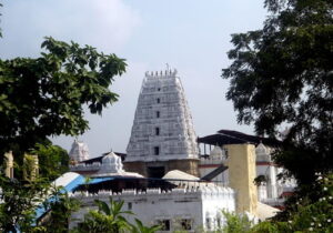
The Gorakhnath Temple at Toranmal is the religious centrepiece of the hill station and the site of one of Maharashtra’s most extraordinary pilgrimage events. The Gorakhnath Temple is the site of a Yatra attended by thousands of devotees on Mahashivratri. On that occasion pilgrims walk barefoot for days from surrounding areas in the Nandurbar district but also from Maharashtra, Madhya Pradesh and Gujarat.
The annual Mahashivratri fair at Gorakhnath Temple draws pilgrims from three states on an extraordinary barefoot pilgrimage — through forests, hills, and tribal villages — to reach the Satpura hilltop shrine. The combination of the religious event, the landscape through which pilgrims travel, and the tribal communities who host them on the way makes the Mahashivratri pilgrimage at Toranmal a genuinely distinctive cultural event.
3. Unapdev Hot Springs — Ramayana Connection
Unapdev is well-known for its natural hot water springs and is located about 6 kilometres from Adavad village in the Shahada taluka. The hot springs flow from a formation resembling a cow’s mouth, lending a unique feature to this secluded spiritual site nestled at the base of the Satpuda hill range. Unapdev, along with Sunapdev and Nijhardev, finds mention in the ancient epic Ramayana and is thought to have been visited by Lord Rama during his fourteen-year period of exile.
The hot springs have been traditionally believed to possess therapeutic properties. The Ramayana connection gives the site a pilgrimage dimension that draws Hindu devotees in addition to those seeking the waters’ reputed medicinal benefits. The setting at the base of the Satpura hills adds to its natural appeal.
4. Asthamba — Tribal Sacred Site and Fair
Situated in the Akrani Tehsil, Asthamba is a revered spiritual location within the Nandurbar area. It is particularly famous for the annual Asthamba fair, regarded as one of the most significant tribal gatherings in South Gujarat and Northwest Maharashtra.
The Asthamba fair is a major event in the Bhil and Pawara tribal calendar, attracting communities from across the district and neighbouring states. Tribal culture, traditional music, Adivasi dance, and the devotional atmosphere of the gathering make it one of the most authentic indigenous cultural events accessible in Maharashtra.
5. Prakasha (Dakshin Kashi) — Ancient Temple Town
Prakasha, also called Dakshin Kashi, happens to be among the oldest temples of the Nandurbar region. It is situated in Shahada Tehsil. The name Dakshin Kashi (Southern Kashi) signals the site’s religious importance within the Varanasi-comparison tradition of significant Shiva pilgrimage sites in peninsular India. The temple town sits on the Tapi River and draws pilgrims from across Khandesh and beyond.
6. Sarangkheda — Shri Datta Temple and Fair
Shri Datta Temple is located at Sarangkheda. A big fair is organized annually in this temple in the commemoration of Datta Jayanti. Sarangkheda, on the Tapi River, is also known for the Sarangkheda Horse Fair — once the largest horse trading fair in the region, attracting buyers from across western India. The fair’s equestrian tradition connects it to the horse-keeping cultures of the Rajput and Maratha communities who passed through the district historically.
7. Akrani Fort and Satpura Wilderness
The Akrani Mahal fort is located in the remote highlands of Akrani taluka, within the Satpura mountain range, believed to have been established by Rajput settlers following the Battle of Haldighati in 1576. The structure occupies an area of approximately 2.5 acres and follows a rectangular plan.
The Akrani taluka’s forested hills are among the most remote and ecologically rich areas in Maharashtra — elephant, leopard, and various deer species inhabit the forests. The Akrani hills’ isolation has preserved a quality of genuine wilderness that the more accessible parts of Maharashtra lost decades ago. This is among the most adventurous and rewarding destinations for visitors willing to organise their own transport and accept limited amenities.
8. Narmada Riverbanks and Dam Views
The Narmada River forms the northern boundary of Nandurbar district with Madhya Pradesh. The Narmada waters along the district’s northern edge, with the Satpura hills rising beyond, create a dramatic riverine landscape that is at its most impressive when the hills are green after the monsoon. The dam infrastructure upstream has created significant reservoir areas that attract birdlife, and the Narmada banks have a spiritual resonance for Hindu pilgrims who regard the river as sacred.
9. Manpura Jain Temple
The ancient Manpura Jain Temple within the district is one of the heritage religious sites representing the historical presence of the Jain trading community in the Khandesh region. The temple’s architecture reflects the craftsmanship of Jain temple-building traditions and is an important stop for visitors tracing the district’s religious diversity.
Tribal Culture and Bhagoria Festival
The most distinctive aspect of Nandurbar district’s cultural identity is its tribal heritage. The Bhil community — one of India’s largest tribal groups — is the dominant population in much of the district. The Pawara community occupies the Satpura hills area. Together, these communities maintain traditions of music, dance, and social customs that are among the most intact in Maharashtra.
Bhagoria Festival — Celebrated in the weeks before Holi (typically February–March), the Bhagoria is a Bhil community tradition in which young men and women of marriageable age gather at market fairs. Young men traditionally approach young women and, if their interest is reciprocated, the couple can elope and formalise the relationship later with the families. The festival atmosphere — music, dancing, colourful dress, and the charged social energy of the gathering — draws visitors from across the district and region who come specifically to observe one of India’s most vividly alive tribal social customs.
Warli-tradition art — The tribal communities of the Nandurbar area practise wall painting and textile decoration in the Warli tradition — white geometric figures on dark backgrounds depicting scenes of daily life, hunting, harvest, and dance. Visitors can encounter authentic traditional wall paintings in tribal villages across the Akrani and Akkalkuwa talukas.
Adivasi Dance Festival — Cultural performances of tribal dance forms including the distinctive Bhil and Pawara dances are staged during major festivals and fairs across the district.
Temples and Religious Sites of Nandurbar District
| Site | Location | Deity / Tradition | Key Feature |
| Gorakhnath Temple | Toranmal, Satpura hills | Lord Shiva (Gorakhnath) | Annual Mahashivratri pilgrimage; barefoot walkers from 3 states |
| Prakasha (Dakshin Kashi) | Shahada taluka, Tapi riverbank | Lord Shiva | Ancient temple town; “Dakshin Kashi” title; significant Shiva pilgrimage |
| Shri Datta Temple | Sarangkheda | Shri Dattatreya | Annual Datta Jayanti fair; associated with famous horse-trading fair |
| Unapdev Hot Springs Temple | Near Adavad, Shahada taluka | Hindu (Ramayana site) | Natural hot water springs; cow-mouth rock formation; Ramayana association |
| Manpura Jain Temple | Nandurbar district | Jain tradition | Ancient Jain heritage; merchant community temple |
| Torna Devi Shrine | Toranmal hilltop | Goddess Torna Devi | Sacred to Bhil tribal communities; fertility goddess |
| Asthamba Sacred Site | Akrani Tehsil | Tribal (Bhil tradition) | Annual Asthamba fair; significant tribal religious gathering |
| Dandpaneshwar Ganesh Temple | Nandurbar area | Lord Ganesha | Important local Ganesh shrine |
Weather in Nandurbar District — Season by Season
The district’s weather varies significantly between the plains near Nandurbar town and the Satpura hillsides around Toranmal.
1. October to May — Best Time for Toranmal
The ideal time to explore Toranmal is from October to May, when the weather is pleasant and favorable for sightseeing. During these months, the temperatures remain moderate, allowing visitors to enjoy outdoor activities comfortably. The post-monsoon season enhances the region’s natural beauty, with vibrant greenery and clear lakes adding to its charm.
October to February is the best overall window for the district — cool and clear, with temperatures in Nandurbar plains around 15–26°C and pleasantly cooler at Toranmal’s 1,150 m elevation. March is the month of the Bhagoria Festival — a specific reason to visit. April and May remain comfortable at Toranmal despite growing heat in the plains.
2. February to March — Bhagoria Season
The Bhagoria Festival draws visitors specifically in this period. Combine a Bhagoria visit with the Mahashivratri pilgrimage at Gorakhnath Temple (also typically February–March) for the fullest cultural experience of the district in a single trip.
3. June to September — Monsoon
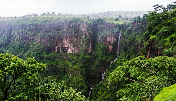
The district receives heavy monsoon rainfall, particularly in the Satpura hills. The Satpura landscape becomes dramatically green. Waterfalls at Horaphali and Walheri are at their best. Road access to some Akrani hill areas can be unreliable. The Unapdev springs and Tapi riverbanks are scenic but the district is not generally recommended for comfortable tourism during peak monsoon.
4. April to May — Pre-Monsoon Heat (Plains)
Temperatures in the plains around Nandurbar town climb to 38–44°C. Toranmal remains significantly cooler and is actually a popular summer retreat for families from Surat and other Gujarat cities during this period.
Things to Do in Nandurbar District (2026)
Visit Toranmal for a Two-Day Stay — Take the road from Shahada (47 km) up to the hilltop. On arrival, visit Yashwant Lake for a boat ride and sunset. Day two: morning visit to the Gorakhnath Temple, trek to Khadki Point for the panoramic view, and explore the Sita-Khaani valley. The Machindranath Cave makes a good afternoon excursion.
Attend the Mahashivratri Pilgrimage at Toranmal — If your visit coincides with Mahashivratri (typically February–March), the atmosphere at Gorakhnath Temple with thousands of barefoot pilgrims arriving from three states is extraordinary. Plan accommodation at Toranmal well in advance for this period.
Witness the Bhagoria Festival — A visit during the weeks before Holi (February–March) to the Bhil community’s Bhagoria gatherings in Akrani or Navapur talukas gives an authentic encounter with one of Maharashtra’s most vibrant living tribal customs. Approach respectfully as an observer.
Unapdev Hot Springs and Prakasha Day Trip — Combine the natural hot spring at Unapdev (Shahada taluka) with a visit to the ancient temple town of Prakasha (Dakshin Kashi) on the Tapi River for a half-day covering both natural and religious heritage.
Drive into Akrani Hills — The remote forested hills of the Akrani taluka require a robust vehicle and local knowledge. The payoff is genuine wilderness, the Akrani Mahal fort, tribal villages with Warli tradition wall paintings, and the Narmada riverbank landscape at the district’s northern edge.
Sarangkheda Horse Fair — If visiting during the Datta Jayanti fair season, Sarangkheda combines religious celebration with the remnants of the historic horse-trading tradition that made this market town regionally famous.
How to Reach Nandurbar District
By Air: Surat Airport in Gujarat is approximately 200 km from Toranmal — closest for visitors from western India. Aurangabad Airport is approximately 280 km from Toranmal. Mumbai’s Chhatrapati Shivaji Maharaj International Airport is approximately 400 km by road.
By Train: Nandurbar Railway Station has connections to Mumbai, Surat, Pune, and other cities on the Central and Western Railway networks. The nearest railway stations are in Nandurbar and Dondaicha, situated around 76 kilometers away from Toranmal. From these stations, taxis and local buses provide easy access to the hill station.
By Road: The most convenient way to reach Toranmal is by road, with regular bus services linking it to nearby cities such as Dhule, Nandurbar, and Shahada. Located around 50 kilometres from Shahada, the journey offers picturesque views of lush green landscapes and winding mountain roads. From Dhule (a larger city), Nandurbar is approximately 70 km.
Practical Tips for Visitors (2026)
- Toranmal is small — accommodation options are limited to government tourist rest houses (MTDC and state government), a few private guesthouses, and eco-stays. Book accommodation ahead, especially for weekends and for Mahashivratri.
- The Bhagoria Festival requires sensitivity and respect — photograph only with permission and engage with communities on their own terms.
- Carry cash throughout — ATMs in Toranmal and Akrani taluka can be unreliable.
- The Akrani hills road is rough; a 4WD vehicle is recommended for the more remote areas.
- Forest clearance is required for some wildlife-sensitive areas near Toranmal — check with the Forest Department locally.
- Toranmal in the monsoon (July–September) can experience road disruptions — check conditions before travelling.
Conclusion
Nandurbar is a district that rewards the traveller who comes specifically seeking it. Unlike the well-trodden Maharashtra tourism circuit of Mumbai-Pune-Nashik-Aurangabad, Nandurbar requires planning, some tolerance for limited amenities, and a genuine interest in what the district actually offers — a hill station of rare quietness in the Satpura range, hot springs with Ramayana associations, ancient temple towns on the Tapi, the country’s most dramatically set tribal pilgrimage (the Mahashivratri barefoot walk to Gorakhnath), and the vivid Bhagoria social festival of the Bhil community. None of these are in any guidebook’s standard Maharashtra circuit. That obscurity is, for the right visitor, the district’s most compelling quality.
FAQs About Nandurbar District, Maharashtra
Q: What is Nandurbar district famous for?
A: Nandurbar is most widely known for Toranmal — a hill station in the Satpura Range at 1,150 metres elevation, famous for its Gorakhnath Temple and Mahashivratri pilgrimage. The district is also known for the Unapdev hot springs (with Ramayana associations), the Asthamba tribal fair, the Bhagoria Festival of the Bhil community, and its significant tribal (Bhil, Pawara) population and culture.
Q: How do you reach Toranmal hill station?
A: Toranmal is approximately 50 km from Shahada town in Nandurbar district. The most convenient approach is by road from Shahada (47 km) or from Nandurbar town (via Shahada). Nandurbar Railway Station is approximately 76 km from Toranmal. Surat Airport in Gujarat (approximately 200 km) is the nearest major airport.
Q: What is the Bhagoria Festival?
A: The Bhagoria Festival is an annual pre-Holi gathering of the Bhil tribal community in which young people of marriageable age meet at market fairs to find partners — traditionally involving elopement if the interest is mutual. Celebrated in February–March across Nandurbar and the extended Khandesh-Bhil region, it is one of India’s most vividly alive tribal social customs and draws visitors from across the region.
Q: When is the best time to visit Nandurbar?
A: October to May is the best period for Toranmal specifically. February–March is the most culturally vibrant time — coinciding with both the Mahashivratri pilgrimage at Gorakhnath Temple and the Bhagoria Festival. Summer (April–May) is good at Toranmal’s elevation but very hot in the plains.
Q: What is Nandurbar district’s connection to the Ramayana?
A: The Unapdev hot springs in Shahada taluka are traditionally believed to have been visited by Lord Rama during his fourteen-year exile, as mentioned in local religious tradition. The springs, which flow from a cow-mouth-shaped rock formation at the base of the Satpura hills, carry this sacred association and draw pilgrims alongside those seeking the waters’ reputedly therapeutic properties.